A new approach to mapping the world could change how the size of countries is perceived. On September 4, 2026, the United Nations General Assembly adopted a resolution encouraging the use of the “Equal Earth” projection, a system designed to represent the relative size of territories more accurately than traditional world maps.
The move puts the spotlight on a long-standing issue in cartography. The Mercator projection, developed in 1569 for maritime navigation, significantly distorts the apparent size of territories as they move farther from the Equator. Northern countries therefore tend to appear much larger than they actually are.
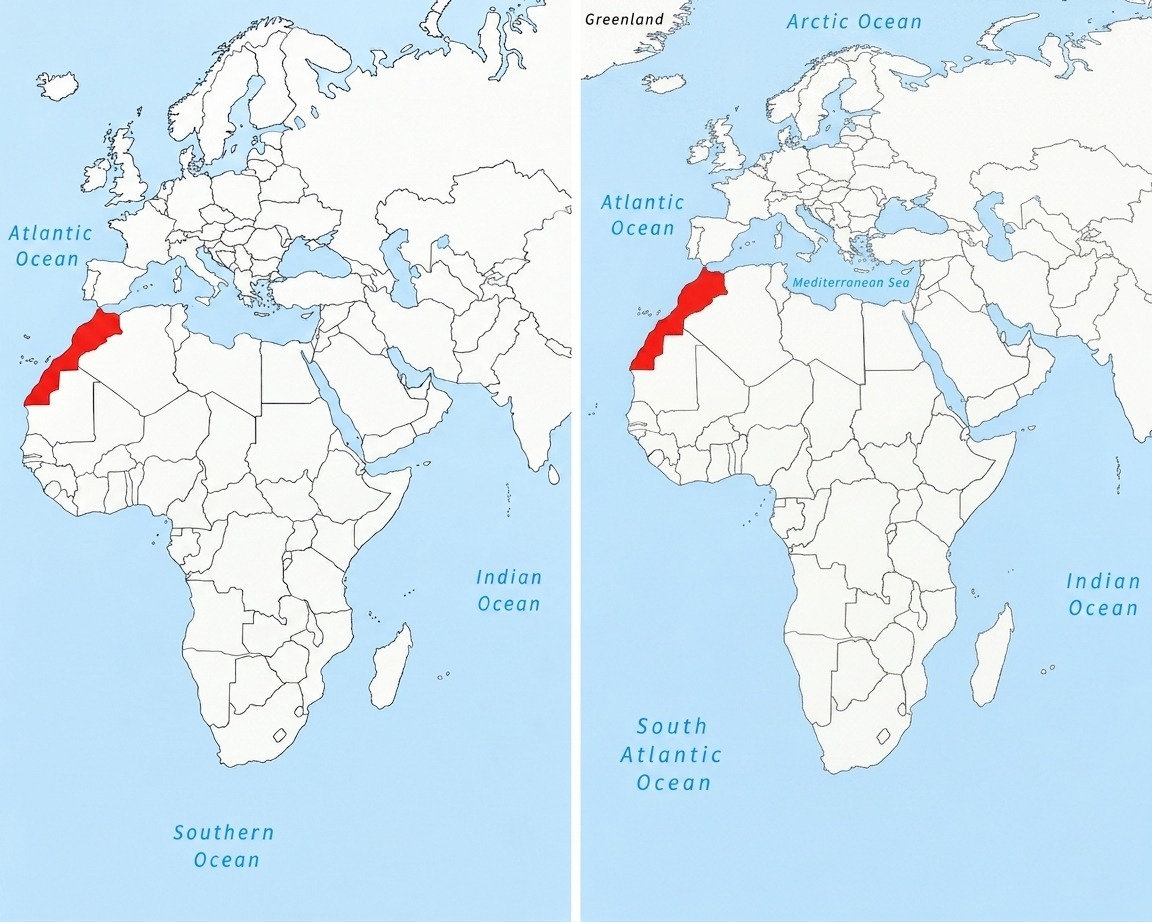
Africa is one of the clearest examples of this distortion. On conventional maps, Greenland can appear almost comparable in size to the African continent, despite Africa being roughly 14 times larger. Equal Earth was designed to preserve the relative surface areas of countries and continents, offering a visual representation closer to their actual proportions.
The difference is particularly noticeable when looking at Morocco. According to the figures cited in the source, the Kingdom covers 710,850 square kilometers, making it larger in area than metropolitan France, Spain and Germany.
On Mercator-based maps, Morocco can appear significantly smaller when placed alongside European countries because of the distortion affecting territories at higher northern latitudes. Equal Earth reduces this visual imbalance and gives a more proportional impression of the Kingdom’s territory.
The effect is also visible in the country’s north-south and east-west dimensions. Morocco’s territory stretches for nearly 2,000 kilometers from the Mediterranean toward the southern reaches of the Sahara, a scale that is less immediately apparent on conventional world maps.
The new projection does not change the actual size of Morocco or any other country. Rather, it changes the way geographical proportions are displayed. No flat world map can completely eliminate distortion because the Earth is spherical, but Equal Earth prioritizes preserving relative areas between territories.
For Morocco, the result is a map that offers a different visual perspective of its place within Africa and in relation to Europe. The Kingdom appears closer to its actual geographic scale, while the broader African continent regains a representation more consistent with its enormous territorial weight.